
our Services
Geospatial Intelligence Services
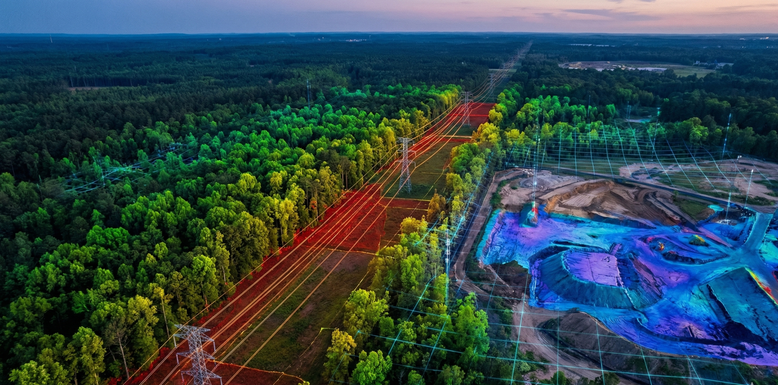
TerraSight delivers advanced geospatial analysis using UAV LiDAR, multispectral sensing, and spatial data analytics to support environmental monitoring, infrastructure risk assessment, and landscape-scale monitoring programs.
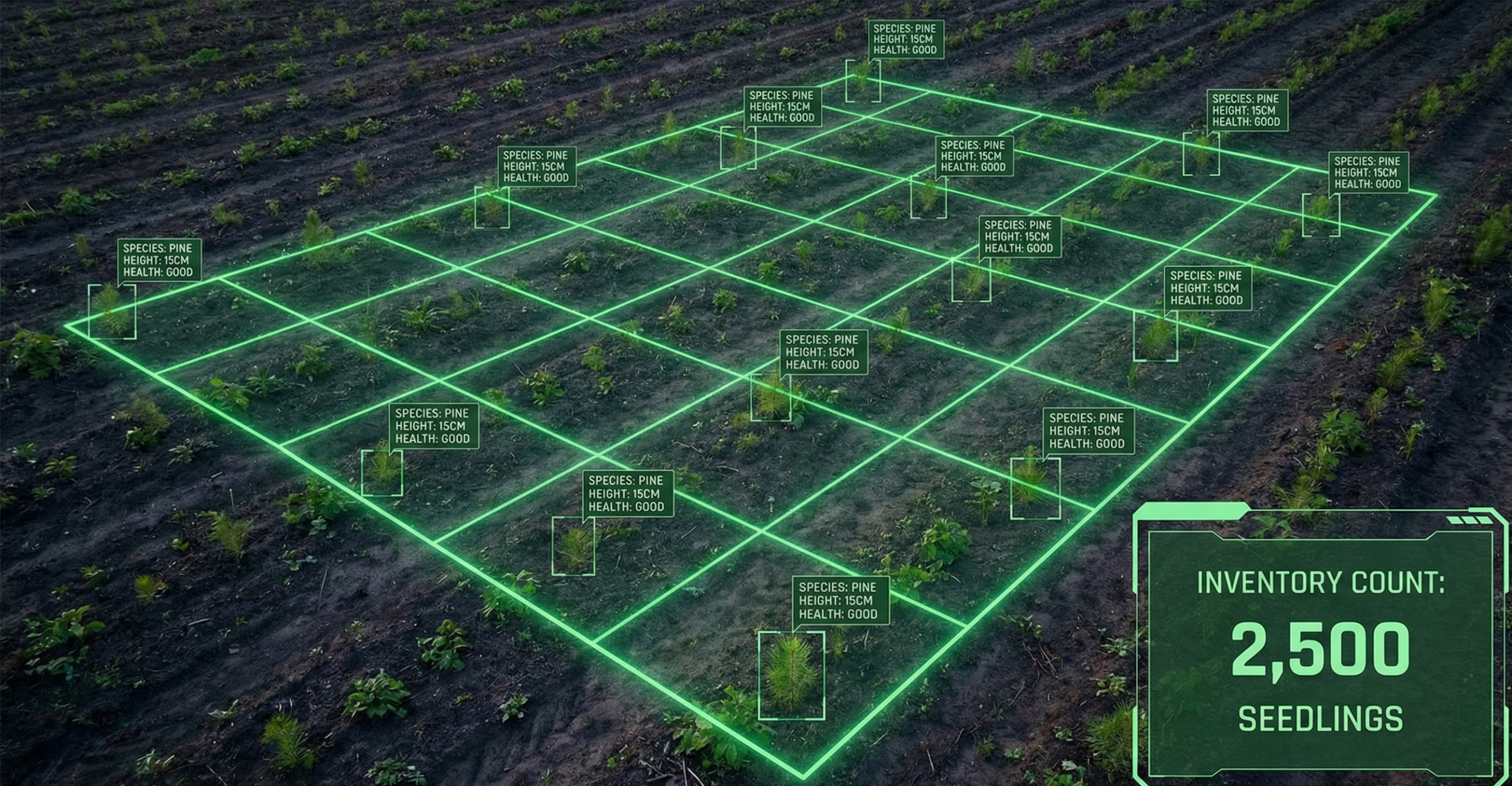
Forestry & Nature-Based Monitoring
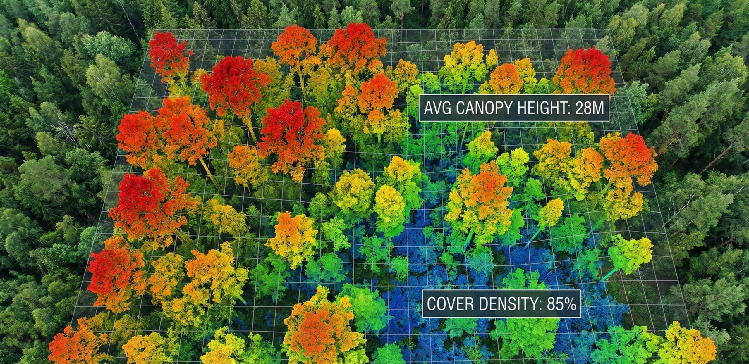
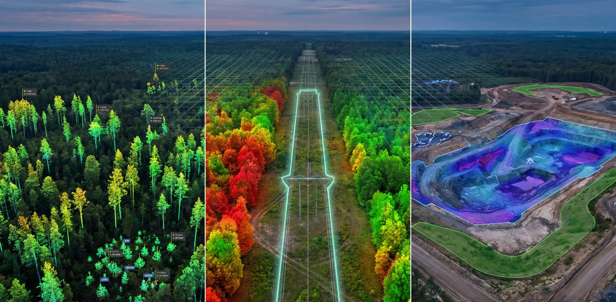
TerraSight uses high-density UAV LiDAR and advanced spatial analysis to generate scalable vegetation intelligence across forests, restoration projects, and large landscapes. Our analysis supports forest monitoring programs, ecosystem restoration initiatives, and nature-based land management.
Capabilities:
Automated seedling detection and inventory
High-precision canopy height and forest structure modeling
Forest density and vegetation classification analysis
Post-wildfire recovery and forest regeneration monitoring
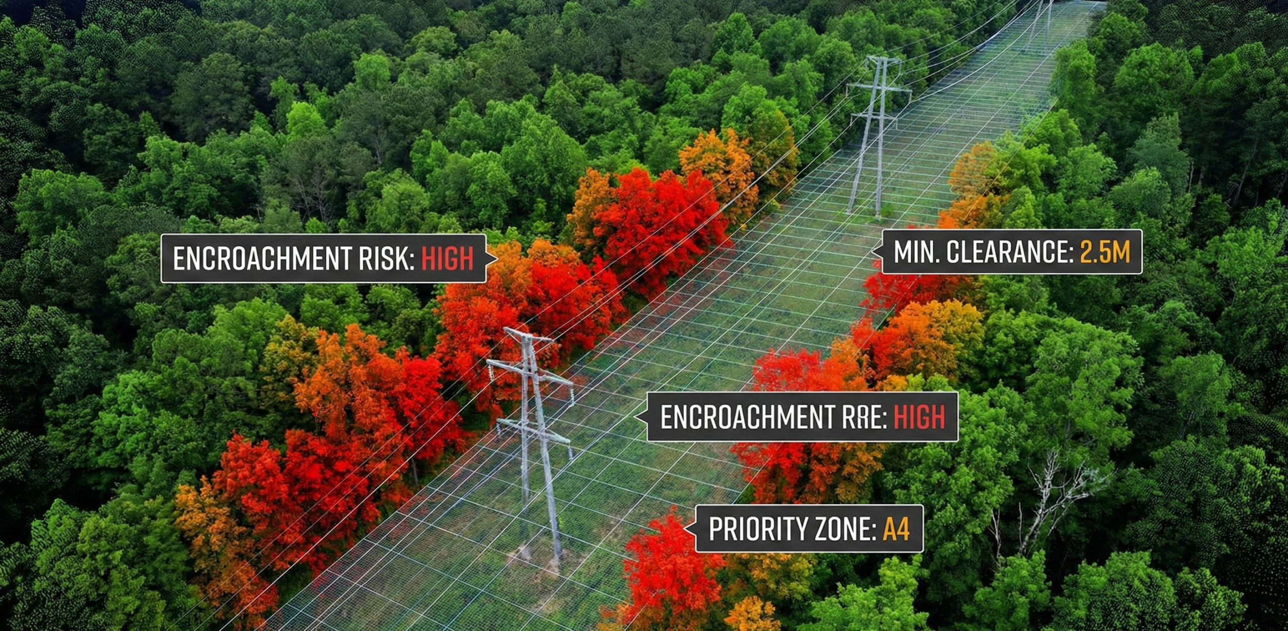
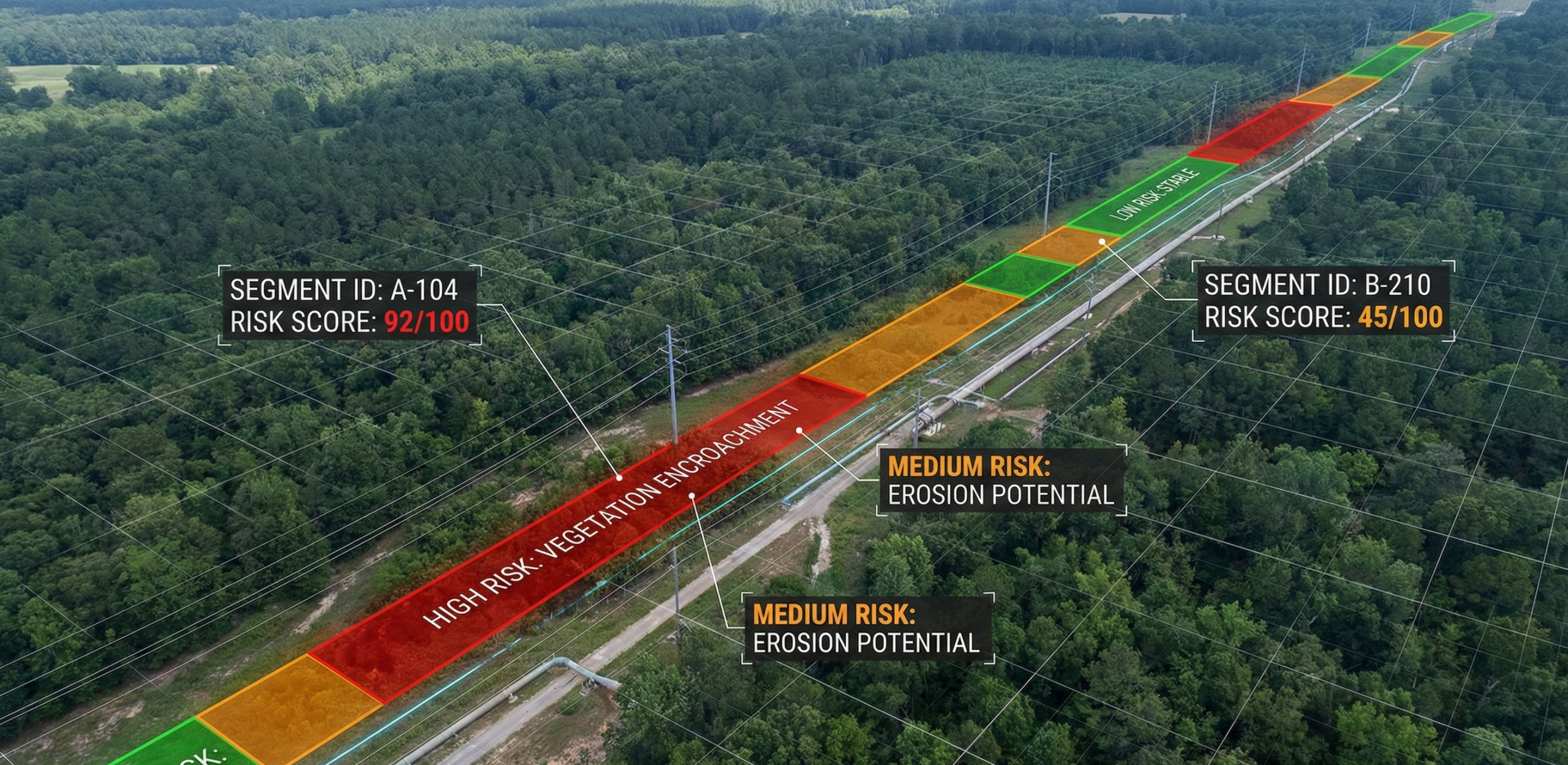
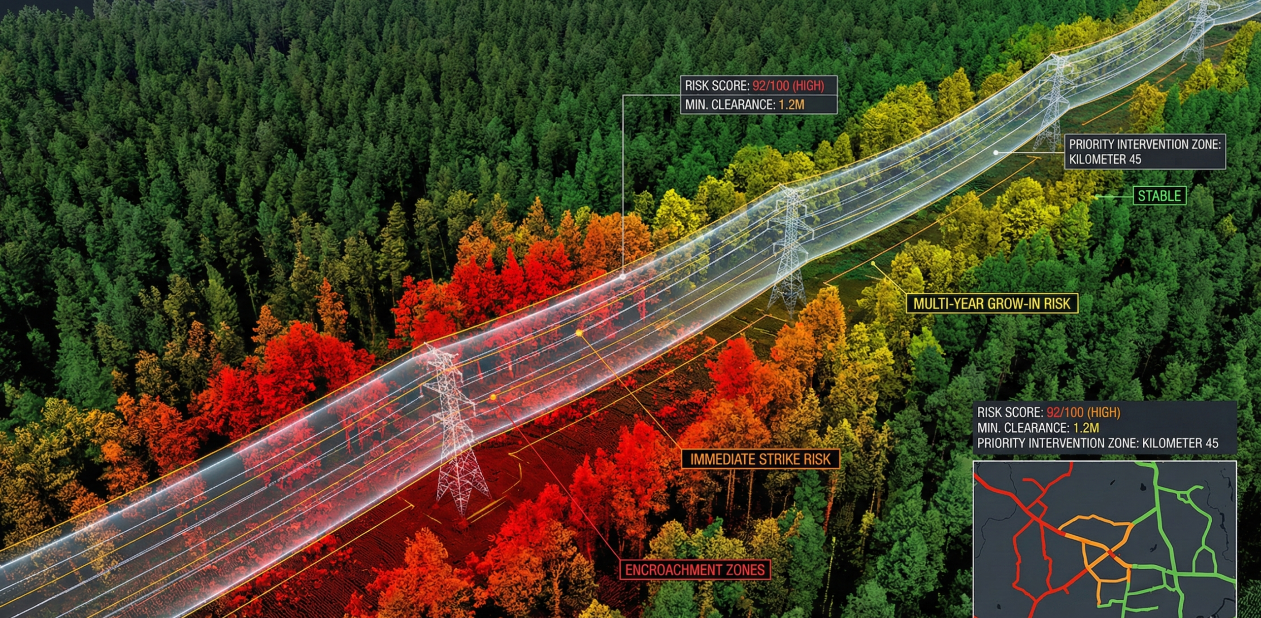
Corridor Vegetation Risk Assessment
TerraSight analyzes vegetation exposure along transmission lines and pipeline corridors, enabling operators to shift from reactive vegetation clearing toward proactive risk management.
Capabilities:
High-precision vegetation clearance analysis
Corridor segmentation based on vegetation risk
Spatial risk scoring along infrastructure corridors
Vegetation management planning and prioritization
Environmental & Site Monitoring
TerraSight supports environmental monitoring programs across mining sites, industrial landscapes, and restoration projects through continuous spatial analysis of vegetation recovery, terrain change, and environmental conditions.
Capabilities:
Habitat and vegetation mapping
Ecological recovery monitoring
Terrain and volumetric change detection
Spatial data supporting environmental compliance reporting
LiDAR & Geospatial Data Processing
Many organizations already collect LiDAR or aerial imagery but lack the analytical capacity to convert raw datasets into operational insight. TerraSight ingests and analyzes existing LiDAR and geospatial datasets to generate structured spatial intelligence products.
Capabilities:
LiDAR classification and terrain modeling
Canopy height and vegetation metrics
Infrastructure clearance analysis
GIS-ready data products and technical reports
Deliverables:
GIS-ready spatial layers
Vegetation classification maps
Canopy height models
Infrastructure clearance analysis maps
Corridor risk segmentation layers
Technical reports and spatial intelligence documentation
Get in touch
Phone:
+1 (778) 951-7740
Email:
office@terrasight.ca
From Data to Decision
TerraSight transforms raw spatial datasets into operational intelligence through a structured analytical workflow.
1. UAV or LiDAR Data Acquisition
2. Data Processing and Spatial Analysis
3. Vegetation and Terrain Intelligence Generation
4. Operational Decision Support
Speak with the TerraSight team to explore how our geospatial intelligence services can support environmental monitoring, vegetation analysis, and infrastructure protection programs.

TerraSight provides geospatial intelligence solutions for vegetation monitoring, infrastructure corridor analysis, and environmental reporting.
Contact Us
Address
#12- 1170 McLean ave, Port Coquitlam
Phone Number
+1 (778) 951-7740
office@terraSight.ca